會員登錄
軟體搜尋
您的位置: 網站首頁 >> 程式軟體光碟 >> 商用管理樂透經營 >> 商品詳情
商品詳情
|
商品編號:CB18403 碟片數量:1片 銷售價格:80 瀏覽次數:17326 
【轉載TXT文檔】 |
您可能也喜歡:
CB43085--Moneyspire 2026 v26.0.7 x64 個人財務軟體 英文破解版
CB43060--Cash Register Pro 4.1.0 收銀軟體 英文破解版
CB42593--ezPaycheck 3.15.18 工資管理軟體 英文破解版
CB42938--SoftwareNetz MyMoney 3.57 個人財務管理軟體 英文破解版
CB42871--MoneyWorks Gold 9.2.3 x64 強大的會計和商業資訊軟體 英文破解版
商品描述
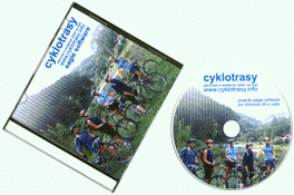
Cyklotrasy v2.19 可幫助自行車自助旅行者規劃旅遊路線的軟體 英文正式版
![]()
破解說明:
CT Eng
JJFZW-J8W8P-5CUGW-CX3UY-4ZJYQ
雙擊cyklotrasy-en註冊表項即可破解!
軟體簡介:
Cyklotrasy v2.19 可幫助自行車自助旅行者規劃旅遊路線的軟體 英文正式版
官方網站:http://cyklotrasy.info/en/
軟體簡介:一款可幫助自行車自助旅行者規劃旅遊路線的軟體。
let me introduce you our software Cyklotrasy (cycling
trails). Imagine software, where you can set (from map or
list) your starting point, some transit places and the
final point of your journey. You can choose searching
preferences, e.g. type of surface, and let the software
plan your own route. The software will get you a lot of
useful information e.g. profile of your trail, map,
itinerary and statistic data.
Cyklotrasy gives you a lot of information, e.g. altitude,
latitude, longitude, photos, texts, lengths of distances,
nubers of roads, numbers of bike-ways, types of surfaces,
hiking and bike marking. You can observe route total
length, superelevation, rise and fall. There are also
prepared routes, where you can find difficulty and type of
recommended bike. You can print profile, map, itinerary and
statistic. Visual apperance of profile and map can be
adjusted with preferences. You can export profile and map
into picture, web site or GPS format. User can make a diary
of his/her trips, including a lot of data. Up to this date
there are 98 maps for Cyklotrasy. Maps are developed by
administrators who update maps at least ones a year.